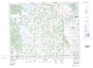
Maps showing Gimli Industrial Park, 20-19-4-E, Manitoba
Gimli Industrial Park is a Unincorporated area located in 20-19-4-E, Manitoba and has an elevation of 229 meters.
- Latitude: 50° 37' 38'' North (decimal: 50.6272000)
- Longitude: 97° 2' 41'' West (decimal: -97.0447000)
- Topography Feature Category: Unincorporated area
- Geographical Feature: Industrial Area
- Canadian Province/Territory: Manitoba
- Elevation: 229 meters
- Location: 20-19-4-E
- Atlas of Canada Locator Map: Gimli Industrial Park
- GPS Coordinate Locator Map: Gimli Industrial Park Lat/Long