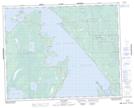
Maps showing Gladstone Heights, Manitoba
Gladstone Heights is a Mountain located in Manitoba and has an elevation of 221 meters.
- Latitude: 51° 34' 27'' North (decimal: 51.5741999)
- Longitude: 96° 45' 14'' West (decimal: -96.7538999)
- Topography Feature Category: Mountain
- Geographical Feature: Hill
- Canadian Province/Territory: Manitoba
- Elevation: 221 meters
- Atlas of Canada Locator Map: Gladstone Heights
- GPS Coordinate Locator Map: Gladstone Heights Lat/Long