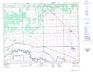
Maps showing Grants Lake Wildlife Management Area, 12-1-W, Manitoba
Grants Lake Wildlife Management Area is a Conservation area located in 12-1-W, Manitoba and has an elevation of 244 meters.
- Latitude: 50° 3' 7'' North (decimal: 50.0518999)
- Longitude: 97° 32' 00'' West (decimal: -97.5332999)
- Topography Feature Category: Conservation area
- Geographical Feature: Wildlife Management Area
- Canadian Province/Territory: Manitoba
- Elevation: 244 meters
- Location: 12-1-W
- Atlas of Canada Locator Map: Grants Lake Wildlife Management Area
- GPS Coordinate Locator Map: Grants Lake Wildlife Management Area Lat/Long