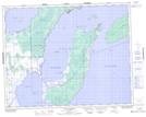
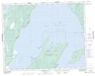
Maps showing Grindstone Provincial Recreation Park, Manitoba
Grindstone Provincial Recreation Park is a Conservation area located in Manitoba and has an elevation of 220 meters.
- Latitude: 51° 15' 38'' North (decimal: 51.2605999)
- Longitude: 96° 44' 58'' West (decimal: -96.7494000)
- Topography Feature Category: Conservation area
- Geographical Feature: Provincial Recreation Park
- Canadian Province/Territory: Manitoba
- Elevation: 220 meters
- Atlas of Canada Locator Map: Grindstone Provincial Recreation Park
- GPS Coordinate Locator Map: Grindstone Provincial Recreation Park Lat/Long
Grindstone Provincial Recreation Park NTS Map Sheets