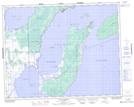
Maps showing Gull Harbour, Manitoba
Gull Harbour is a Unincorporated area located in Manitoba and has an elevation of 219 meters.
- Latitude: 51° 11' 57'' North (decimal: 51.1992000)
- Longitude: 96° 37' 12'' West (decimal: -96.6200000)
- Topography Feature Category: Unincorporated area
- Geographical Feature: Locality
- Canadian Province/Territory: Manitoba
- Elevation: 219 meters
- Atlas of Canada Locator Map: Gull Harbour
- GPS Coordinate Locator Map: Gull Harbour Lat/Long