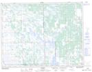
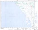
Maps showing Hatchery Drain, 17-19-5-W, Manitoba
Hatchery Drain is a Hydraulic construction located in 17-19-5-W, Manitoba and has an elevation of 248 meters.
- Latitude: 50° 37' 55'' North (decimal: 50.6319000)
- Longitude: 98° 7' 22'' West (decimal: -98.1228000)
- Topography Feature Category: Hydraulic construction
- Geographical Feature: Drain
- Canadian Province/Territory: Manitoba
- Elevation: 248 meters
- Location: 17-19-5-W
- Atlas of Canada Locator Map: Hatchery Drain
- GPS Coordinate Locator Map: Hatchery Drain Lat/Long
Hatchery Drain NTS Map Sheets