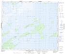
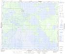
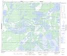
Maps showing Head River, Manitoba
Head River is a River located in Manitoba and has an elevation of 255 meters.
- Latitude: 53° 35' 55'' North (decimal: 53.5985999)
- Longitude: 100° 31' 39'' West (decimal: -100.5274999)
- Topography Feature Category: River
- Geographical Feature: Channel
- Canadian Province/Territory: Manitoba
- Elevation: 255 meters
- Atlas of Canada Locator Map: Head River
- GPS Coordinate Locator Map: Head River Lat/Long
Head River NTS Map Sheets