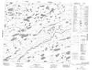
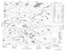
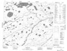
Maps showing High Hill River, 22-79-18-E, Manitoba
High Hill River is a River located in 22-79-18-E, Manitoba and has an elevation of 157 meters.
- Latitude: 55° 51' 27'' North (decimal: 55.8574999)
- Longitude: 94° 41' 50'' West (decimal: -94.6972000)
- Topography Feature Category: River
- Geographical Feature: River
- Canadian Province/Territory: Manitoba
- Elevation: 157 meters
- Location: 22-79-18-E
- Atlas of Canada Locator Map: High Hill River
- GPS Coordinate Locator Map: High Hill River Lat/Long
High Hill River NTS Map Sheets