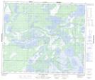
Maps showing Hill Island, Manitoba
Hill Island is a Island located in Manitoba.
- Latitude: 53° 37' 0'' North (decimal: 53.6167000)
- Longitude: 100° 49' 45'' West (decimal: -100.8292000)
- Topography Feature Category: Island
- Geographical Feature: Island
- Canadian Province/Territory: Manitoba
- GPS Coordinate Locator Map: Hill Island Lat/Long
Hill Island NTS Map Sheets