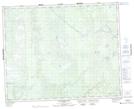
Maps showing Hooker Lake, Manitoba
Hooker Lake is a Lake located in Manitoba.
- Latitude: 51° 51' 47'' North (decimal: 51.8630999)
- Longitude: 96° 1' 14'' West (decimal: -96.0206000)
- Topography Feature Category: Lake
- Geographical Feature: Lake
- Canadian Province/Territory: Manitoba
- GPS Coordinate Locator Map: Hooker Lake Lat/Long
Hooker Lake NTS Map Sheets