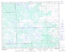
Maps showing Hunter Lake, 17,18-23-3-W, Manitoba
Hunter Lake is a Lake located in 17,18-23-3-W, Manitoba and has an elevation of 280 meters.
- Latitude: 50° 59' 23'' North (decimal: 50.9896999)
- Longitude: 97° 51' 22'' West (decimal: -97.8561000)
- Topography Feature Category: Lake
- Geographical Feature: Lake
- Canadian Province/Territory: Manitoba
- Elevation: 280 meters
- Location: 17,18-23-3-W
- Atlas of Canada Locator Map: Hunter Lake
- GPS Coordinate Locator Map: Hunter Lake Lat/Long
Hunter Lake NTS Map Sheets