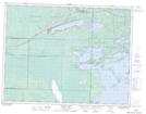
Maps showing Indian Bay, 1-8-17-W, Manitoba
Indian Bay is a Bay located in 1-8-17-W, Manitoba and has an elevation of 333 meters.
- Latitude: 49° 37' 17'' North (decimal: 49.6213999)
- Longitude: 95° 10' 55'' West (decimal: -95.1819000)
- Topography Feature Category: Bay
- Geographical Feature: Bay
- Canadian Province/Territory: Manitoba
- Elevation: 333 meters
- Location: 1-8-17-W
- Atlas of Canada Locator Map: Indian Bay
- GPS Coordinate Locator Map: Indian Bay Lat/Long