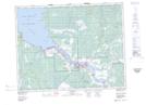
Maps showing Jackfish Creek, 19-8-E, Manitoba
Jackfish Creek is a River located in 19-8-E, Manitoba and has an elevation of 225 meters.
- Latitude: 50° 38' 29'' North (decimal: 50.6413999)
- Longitude: 96° 26' 21'' West (decimal: -96.4391999)
- Topography Feature Category: River
- Geographical Feature: Creek
- Canadian Province/Territory: Manitoba
- Elevation: 225 meters
- Location: 19-8-E
- Atlas of Canada Locator Map: Jackfish Creek
- GPS Coordinate Locator Map: Jackfish Creek Lat/Long