Canada Topographic Maps

Jackfish Point Topo Maps

Topography maps and Latitude/Longitude Location

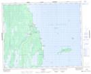
Maps showing Jackfish Point, Manitoba

Jackfish Point is a Cape located in Manitoba.

  • Latitude: 51° 54' 26'' North   (decimal: 51.9071999)
  • Longitude: 97° 17' 13'' West   (decimal: -97.2868999)
  • Topography Feature Category: Cape
  • Geographical Feature: Point
  • Canadian Province/Territory: Manitoba
  • GPS Coordinate Locator Map: Jackfish Point Lat/Long

Jackfish Point NTS Map Sheets

062P14 Jackhead Topographic Map at 1:50,000 scale

062P Hecla Topographic Map at 1:250,000 scale

 
Buy Topographic Maps DVD
Newsletter Sign-up

Yes, I want to receive map store discounts.


Bookmark and Share