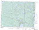
Maps showing Jessica Lake Bog, 12-15-E, Manitoba
Jessica Lake Bog is a Low vegetation located in 12-15-E, Manitoba and has an elevation of 317 meters.
- Latitude: 49° 58' 18'' North (decimal: 49.9717000)
- Longitude: 95° 27' 37'' West (decimal: -95.4603000)
- Topography Feature Category: Low vegetation
- Geographical Feature: Bog
- Canadian Province/Territory: Manitoba
- Elevation: 317 meters
- Location: 12-15-E
- Atlas of Canada Locator Map: Jessica Lake Bog
- GPS Coordinate Locator Map: Jessica Lake Bog Lat/Long