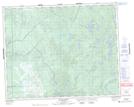
Maps showing Kaneeshotaykwayak Creek, 29-9-E, Manitoba
Kaneeshotaykwayak Creek is a River located in 29-9-E, Manitoba and has an elevation of 260 meters.
- Latitude: 51° 30' 25'' North (decimal: 51.5069000)
- Longitude: 96° 12' 57'' West (decimal: -96.2157999)
- Topography Feature Category: River
- Geographical Feature: Creek
- Canadian Province/Territory: Manitoba
- Elevation: 260 meters
- Location: 29-9-E
- Atlas of Canada Locator Map: Kaneeshotaykwayak Creek
- GPS Coordinate Locator Map: Kaneeshotaykwayak Creek Lat/Long