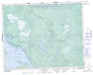
Maps showing Kanesosink Rapids, 27-8-E, Manitoba
Kanesosink Rapids is a Rapids located in 27-8-E, Manitoba and has an elevation of 233 meters.
- Latitude: 51° 21' 3'' North (decimal: 51.3507999)
- Longitude: 96° 20' 46'' West (decimal: -96.3460999)
- Topography Feature Category: Rapids
- Geographical Feature: Rapids
- Canadian Province/Territory: Manitoba
- Elevation: 233 meters
- Location: 27-8-E
- Atlas of Canada Locator Map: Kanesosink Rapids
- GPS Coordinate Locator Map: Kanesosink Rapids Lat/Long