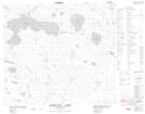
Maps showing Kapakaytay Falls, 32,33-81-5--W, Manitoba
Kapakaytay Falls is a Falls located in 32,33-81-5--W, Manitoba and has an elevation of 245 meters.
- Latitude: 56° 3' 55'' North (decimal: 56.0652999)
- Longitude: 98° 12' 2'' West (decimal: -98.2005999)
- Topography Feature Category: Falls
- Geographical Feature: Falls
- Canadian Province/Territory: Manitoba
- Elevation: 245 meters
- Location: 32,33-81-5--W
- Atlas of Canada Locator Map: Kapakaytay Falls
- GPS Coordinate Locator Map: Kapakaytay Falls Lat/Long
Kapakaytay Falls NTS Map Sheets