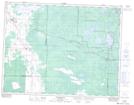
Maps showing Kellner Creek, 18-11-12-E, Manitoba
Kellner Creek is a River located in 18-11-12-E, Manitoba and has an elevation of 274 meters.
- Latitude: 49° 54' 7'' North (decimal: 49.9019000)
- Longitude: 95° 56' 53'' West (decimal: -95.9481000)
- Topography Feature Category: River
- Geographical Feature: Creek
- Canadian Province/Territory: Manitoba
- Elevation: 274 meters
- Location: 18-11-12-E
- Atlas of Canada Locator Map: Kellner Creek
- GPS Coordinate Locator Map: Kellner Creek Lat/Long