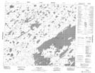
Maps showing Keyask River, Manitoba
Keyask River is a River located in Manitoba and has an elevation of 180 meters.
- Latitude: 55° 1' 51'' North (decimal: 55.0307999)
- Longitude: 94° 35' 18'' West (decimal: -94.5882999)
- Topography Feature Category: River
- Geographical Feature: River
- Canadian Province/Territory: Manitoba
- Elevation: 180 meters
- Atlas of Canada Locator Map: Keyask River
- GPS Coordinate Locator Map: Keyask River Lat/Long
Keyask River NTS Map Sheets