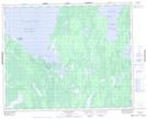
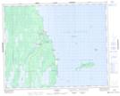
Maps showing Kinwow Bay Creek, 21-34-1-W, Manitoba
Kinwow Bay Creek is a River located in 21-34-1-W, Manitoba and has an elevation of 239 meters.
- Latitude: 51° 56' 20'' North (decimal: 51.9389000)
- Longitude: 97° 33' 8'' West (decimal: -97.5522000)
- Topography Feature Category: River
- Geographical Feature: Creek
- Canadian Province/Territory: Manitoba
- Elevation: 239 meters
- Location: 21-34-1-W
- Atlas of Canada Locator Map: Kinwow Bay Creek
- GPS Coordinate Locator Map: Kinwow Bay Creek Lat/Long
Kinwow Bay Creek NTS Map Sheets