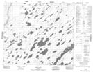
Maps showing Kokasanakaw River, Manitoba
Kokasanakaw River is a River located in Manitoba and has an elevation of 166 meters.
- Latitude: 55° 18' 31'' North (decimal: 55.3086108)
- Longitude: 94° 4' 21'' West (decimal: -94.0724998)
- Topography Feature Category: River
- Geographical Feature: River
- Canadian Province/Territory: Manitoba
- Elevation: 166 meters
- Atlas of Canada Locator Map: Kokasanakaw River
- GPS Coordinate Locator Map: Kokasanakaw River Lat/Long
Kokasanakaw River NTS Map Sheets