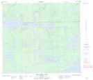
Maps showing Kowapeeministiko Narrows, 30-88-4-W, Manitoba
Kowapeeministiko Narrows is a Channel located in 30-88-4-W, Manitoba and has an elevation of 271 meters.
- Latitude: 56° 39' 43'' North (decimal: 56.6618999)
- Longitude: 98° 5' 21'' West (decimal: -98.0892000)
- Topography Feature Category: Channel
- Geographical Feature: Narrows
- Canadian Province/Territory: Manitoba
- Elevation: 271 meters
- Location: 30-88-4-W
- Atlas of Canada Locator Map: Kowapeeministiko Narrows
- GPS Coordinate Locator Map: Kowapeeministiko Narrows Lat/Long
Kowapeeministiko Narrows NTS Map Sheets