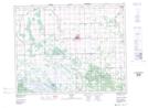
Maps showing Ledwyn, 17-23-3-E, Manitoba
Ledwyn is a Unincorporated area located in 17-23-3-E, Manitoba and has an elevation of 223 meters.
- Latitude: 50° 59' 36'' North (decimal: 50.9933000)
- Longitude: 97° 8' 1'' West (decimal: -97.1336000)
- Topography Feature Category: Unincorporated area
- Geographical Feature: Locality
- Canadian Province/Territory: Manitoba
- Elevation: 223 meters
- Location: 17-23-3-E
- Atlas of Canada Locator Map: Ledwyn
- GPS Coordinate Locator Map: Ledwyn Lat/Long