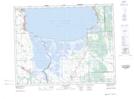
Maps showing Libau, 9,16-15-6-E, Manitoba
Libau is a Unincorporated area located in 9,16-15-6-E, Manitoba and has an elevation of 232 meters.
- Latitude: 50° 16' 8'' North (decimal: 50.2689000)
- Longitude: 96° 43' 9'' West (decimal: -96.7191999)
- Topography Feature Category: Unincorporated area
- Geographical Feature: Community
- Canadian Province/Territory: Manitoba
- Elevation: 232 meters
- Location: 9,16-15-6-E
- Atlas of Canada Locator Map: Libau
- GPS Coordinate Locator Map: Libau Lat/Long
Libau NTS Map Sheets