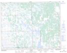
Maps showing Lindals Point, 18,19-2-W, Manitoba
Lindals Point is a Cape located in 18,19-2-W, Manitoba and has an elevation of 269 meters.
- Latitude: 50° 35' 48'' North (decimal: 50.5966999)
- Longitude: 97° 41' 39'' West (decimal: -97.6942000)
- Topography Feature Category: Cape
- Geographical Feature: Point
- Canadian Province/Territory: Manitoba
- Elevation: 269 meters
- Location: 18,19-2-W
- Atlas of Canada Locator Map: Lindals Point
- GPS Coordinate Locator Map: Lindals Point Lat/Long