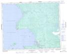
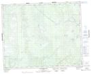
Maps showing Long Body Creek, Manitoba
Long Body Creek is a River located in Manitoba and has an elevation of 220 meters.
- Latitude: 51° 45' 19'' North (decimal: 51.7553000)
- Longitude: 96° 40' 14'' West (decimal: -96.6706000)
- Topography Feature Category: River
- Geographical Feature: Creek
- Canadian Province/Territory: Manitoba
- Elevation: 220 meters
- Atlas of Canada Locator Map: Long Body Creek
- GPS Coordinate Locator Map: Long Body Creek Lat/Long
Long Body Creek NTS Map Sheets