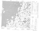
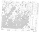
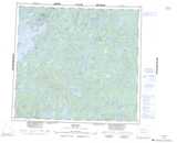
Maps showing Long Point, Manitoba
Long Point is a Cape located in Manitoba and has an elevation of 338 meters.
- Latitude: 57° 48' 40'' North (decimal: 57.8111000)
- Longitude: 101° 54' 19'' West (decimal: -101.9053000)
- Topography Feature Category: Cape
- Geographical Feature: Point
- Canadian Province/Territory: Manitoba
- Elevation: 338 meters
- Atlas of Canada Locator Map: Long Point
- GPS Coordinate Locator Map: Long Point Lat/Long
Long Point NTS Map Sheets