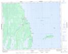
Maps showing Louis Island, Manitoba
Louis Island is a Island located in Manitoba and has an elevation of 219 meters.
- Latitude: 51° 45' 57'' North (decimal: 51.7658000)
- Longitude: 97° 11' 42'' West (decimal: -97.1949999)
- Topography Feature Category: Island
- Geographical Feature: Island
- Canadian Province/Territory: Manitoba
- Elevation: 219 meters
- Atlas of Canada Locator Map: Louis Island
- GPS Coordinate Locator Map: Louis Island Lat/Long