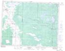
Maps showing Mallard Bay, 16-12-15-E, Manitoba
Mallard Bay is a Bay located in 16-12-15-E, Manitoba and has an elevation of 312 meters.
- Latitude: 49° 59' 44'' North (decimal: 49.9956000)
- Longitude: 95° 30' 3'' West (decimal: -95.5007999)
- Topography Feature Category: Bay
- Geographical Feature: Bay
- Canadian Province/Territory: Manitoba
- Elevation: 312 meters
- Location: 16-12-15-E
- Atlas of Canada Locator Map: Mallard Bay
- GPS Coordinate Locator Map: Mallard Bay Lat/Long