Canada Topographic Maps

Manitou Point Topo Maps

Topography maps and Latitude/Longitude Location

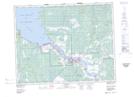
Maps showing Manitou Point, Manitoba

Manitou Point is a Cape located in Manitoba.

  • Latitude: 50° 34' 22'' North   (decimal: 50.5727999)
  • Longitude: 96° 13' 2'' West   (decimal: -96.2172000)
  • Topography Feature Category: Cape
  • Geographical Feature: Point
  • Canadian Province/Territory: Manitoba
  • GPS Coordinate Locator Map: Manitou Point Lat/Long

Manitou Point NTS Map Sheets

062I09 Pine Falls Topographic Map at 1:50,000 scale

062I Selkirk Topographic Map at 1:250,000 scale

 
Buy Topographic Maps DVD
Newsletter Sign-up

Yes, I want to receive map store discounts.


Bookmark and Share