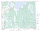
Maps showing Many Islands Point, 1,12-29-2-E, Manitoba
Many Islands Point is a Cape located in 1,12-29-2-E, Manitoba and has an elevation of 219 meters.
- Latitude: 51° 27' 48'' North (decimal: 51.4633000)
- Longitude: 97° 11' 28'' West (decimal: -97.1910999)
- Topography Feature Category: Cape
- Geographical Feature: Point
- Canadian Province/Territory: Manitoba
- Elevation: 219 meters
- Location: 1,12-29-2-E
- Atlas of Canada Locator Map: Many Islands Point
- GPS Coordinate Locator Map: Many Islands Point Lat/Long