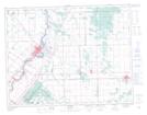
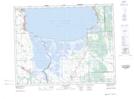
Maps showing Mars Sand Hills, 14,15-7-E, Manitoba
Mars Sand Hills is a Mountain located in 14,15-7-E, Manitoba and has an elevation of 267 meters.
- Latitude: 50° 15' North (decimal: 50.2499999)
- Longitude: 96° 35' West (decimal: -96.5833000)
- Topography Feature Category: Mountain
- Geographical Feature: Sand Hills
- Canadian Province/Territory: Manitoba
- Elevation: 267 meters
- Location: 14,15-7-E
- Atlas of Canada Locator Map: Mars Sand Hills
- GPS Coordinate Locator Map: Mars Sand Hills Lat/Long
Mars Sand Hills NTS Map Sheets