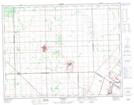
Maps showing Miller, Manitoba
Miller is a Unincorporated area located in Manitoba.
- Latitude: 50° 2' North (decimal: 50.0333000)
- Longitude: 97° 3' West (decimal: -97.0500000)
- Topography Feature Category: Unincorporated area
- Geographical Feature: Settlement
- Canadian Province/Territory: Manitoba
- GPS Coordinate Locator Map: Miller Lat/Long