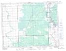
Maps showing Milner Ridge, 12,13,14-9-E;13,14-10-E, Manitoba
Milner Ridge is a Mountain located in 12,13,14-9-E;13,14-10-E, Manitoba and has an elevation of 260 meters.
- Latitude: 50° 8' 18'' North (decimal: 50.1383000)
- Longitude: 96° 13' 6'' West (decimal: -96.2183000)
- Topography Feature Category: Mountain
- Geographical Feature: Ridge
- Canadian Province/Territory: Manitoba
- Elevation: 260 meters
- Location: 12,13,14-9-E;13,14-10-E
- Atlas of Canada Locator Map: Milner Ridge
- GPS Coordinate Locator Map: Milner Ridge Lat/Long