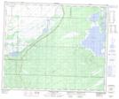
Maps showing Mistikewapi Lake, 18,19-55-24-W, Manitoba
Mistikewapi Lake is a Lake located in 18,19-55-24-W, Manitoba and has an elevation of 260 meters.
- Latitude: 53° 45' 1'' North (decimal: 53.7502999)
- Longitude: 101° 0' 10'' West (decimal: -101.0027999)
- Topography Feature Category: Lake
- Geographical Feature: Lake
- Canadian Province/Territory: Manitoba
- Elevation: 260 meters
- Location: 18,19-55-24-W
- Atlas of Canada Locator Map: Mistikewapi Lake
- GPS Coordinate Locator Map: Mistikewapi Lake Lat/Long
Mistikewapi Lake NTS Map Sheets