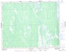
Maps showing Moorhen River, 10-32-1-W, Manitoba
Moorhen River is a River located in 10-32-1-W, Manitoba and has an elevation of 226 meters.
- Latitude: 51° 43' 43'' North (decimal: 51.7285999)
- Longitude: 97° 30' 36'' West (decimal: -97.5099999)
- Topography Feature Category: River
- Geographical Feature: River
- Canadian Province/Territory: Manitoba
- Elevation: 226 meters
- Location: 10-32-1-W
- Atlas of Canada Locator Map: Moorhen River
- GPS Coordinate Locator Map: Moorhen River Lat/Long