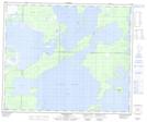
Maps showing Moose Lake Narrows Control Structure, 57-19-W, Manitoba
Moose Lake Narrows Control Structure is a Hydraulic construction located in 57-19-W, Manitoba.
- Latitude: 53° 56' 9'' North (decimal: 53.9358000)
- Longitude: 100° 8' 46'' West (decimal: -100.1461000)
- Topography Feature Category: Hydraulic construction
- Geographical Feature: Control Structure
- Canadian Province/Territory: Manitoba
- Location: 57-19-W
- Atlas of Canada Locator Map: Moose Lake Narrows Control Structure
- GPS Coordinate Locator Map: Moose Lake Narrows Control Structure Lat/Long
Moose Lake Narrows Control Structure NTS Map Sheets