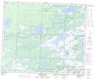
Maps showing Mustutimmuskisin Marsh, 55-28-W, Manitoba
Mustutimmuskisin Marsh is a Low vegetation located in 55-28-W, Manitoba.
- Latitude: 53° 46' 22'' North (decimal: 53.7728000)
- Longitude: 101° 34' 36'' West (decimal: -101.5767000)
- Topography Feature Category: Low vegetation
- Geographical Feature: Marsh
- Canadian Province/Territory: Manitoba
- Location: 55-28-W
- Atlas of Canada Locator Map: Mustutimmuskisin Marsh
- GPS Coordinate Locator Map: Mustutimmuskisin Marsh Lat/Long
Mustutimmuskisin Marsh NTS Map Sheets