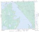
Maps showing Namay Rapids, 31-7-E, Manitoba
Namay Rapids is a Rapids located in 31-7-E, Manitoba and has an elevation of 224 meters.
- Latitude: 51° 39' 26'' North (decimal: 51.6571999)
- Longitude: 96° 31' 33'' West (decimal: -96.5257999)
- Topography Feature Category: Rapids
- Geographical Feature: Rapids
- Canadian Province/Territory: Manitoba
- Elevation: 224 meters
- Location: 31-7-E
- Atlas of Canada Locator Map: Namay Rapids
- GPS Coordinate Locator Map: Namay Rapids Lat/Long