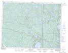
Maps showing Neve Island, 35-10-15-E, Manitoba
Neve Island is a Island located in 35-10-15-E, Manitoba and has an elevation of 335 meters.
- Latitude: 49° 52' 41'' North (decimal: 49.8780999)
- Longitude: 95° 26' 8'' West (decimal: -95.4355999)
- Topography Feature Category: Island
- Geographical Feature: Island
- Canadian Province/Territory: Manitoba
- Elevation: 335 meters
- Location: 35-10-15-E
- Atlas of Canada Locator Map: Neve Island
- GPS Coordinate Locator Map: Neve Island Lat/Long