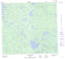
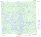
Maps showing Northern Indian Lake, Manitoba
Northern Indian Lake is a Lake located in Manitoba and has an elevation of 234 meters.
- Latitude: 57° 20' 10'' North (decimal: 57.3360999)
- Longitude: 97° 15' 0'' West (decimal: -97.2500000)
- Topography Feature Category: Lake
- Geographical Feature: Lake
- Canadian Province/Territory: Manitoba
- Elevation: 234 meters
- Atlas of Canada Locator Map: Northern Indian Lake
- GPS Coordinate Locator Map: Northern Indian Lake Lat/Long
Northern Indian Lake NTS Map Sheets