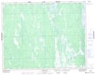
Maps showing Northwest Creek, 35-30-2W, Manitoba
Northwest Creek is a River located in 35-30-2W, Manitoba and has an elevation of 228 meters.
- Latitude: 51° 36' 37'' North (decimal: 51.6103000)
- Longitude: 97° 38' 14'' West (decimal: -97.6372000)
- Topography Feature Category: River
- Geographical Feature: Creek
- Canadian Province/Territory: Manitoba
- Elevation: 228 meters
- Location: 35-30-2W
- Atlas of Canada Locator Map: Northwest Creek
- GPS Coordinate Locator Map: Northwest Creek Lat/Long