Canada Topographic Maps

Osier Creek Topo Maps

Topography maps and Latitude/Longitude Location

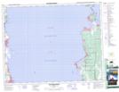
Maps showing Osier Creek, Manitoba

Osier Creek is a River located in Manitoba.

  • Latitude: 50° 34' 34'' North   (decimal: 50.5761000)
  • Longitude: 96° 58' 52'' West   (decimal: -96.9811000)
  • Topography Feature Category: River
  • Geographical Feature: Creek
  • Canadian Province/Territory: Manitoba
  • GPS Coordinate Locator Map: Osier Creek Lat/Long

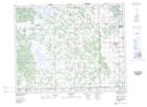
Osier Creek NTS Map Sheets

062I10 Victoria Beach Topographic Map at 1:50,000 scale

062I11 Fraserwood Topographic Map at 1:50,000 scale

062I Selkirk Topographic Map at 1:250,000 scale

 
Buy Topographic Maps DVD
Newsletter Sign-up

Yes, I want to receive map store discounts.


Bookmark and Share