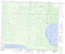
Maps showing Overflowing River Provincial Recreation Park, Manitoba
Overflowing River Provincial Recreation Park is a Conservation area located in Manitoba.
- Latitude: 53° 8' 23'' North (decimal: 53.1396999)
- Longitude: 101° 5' 15'' West (decimal: -101.0874999)
- Topography Feature Category: Conservation area
- Geographical Feature: Provincial Recreation Park
- Canadian Province/Territory: Manitoba
- GPS Coordinate Locator Map: Overflowing River Provincial Recreation Park Lat/Long
Overflowing River Provincial Recreation Park NTS Map Sheets