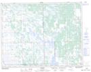
Maps showing Pauls Lake, 4,9-19-1-W, Manitoba
Pauls Lake is a Lake located in 4,9-19-1-W, Manitoba and has an elevation of 273 meters.
- Latitude: 50° 36' 38'' North (decimal: 50.6105999)
- Longitude: 97° 32' 54'' West (decimal: -97.5483000)
- Topography Feature Category: Lake
- Geographical Feature: Lake
- Canadian Province/Territory: Manitoba
- Elevation: 273 meters
- Location: 4,9-19-1-W
- Atlas of Canada Locator Map: Pauls Lake
- GPS Coordinate Locator Map: Pauls Lake Lat/Long