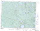
Maps showing Peanut Island, 16-9-17-E, Manitoba
Peanut Island is a Island located in 16-9-17-E, Manitoba and has an elevation of 334 meters.
- Latitude: 49° 45' 5'' North (decimal: 49.7514000)
- Longitude: 95° 12' 19'' West (decimal: -95.2053000)
- Topography Feature Category: Island
- Geographical Feature: Island
- Canadian Province/Territory: Manitoba
- Elevation: 334 meters
- Location: 16-9-17-E
- Atlas of Canada Locator Map: Peanut Island
- GPS Coordinate Locator Map: Peanut Island Lat/Long