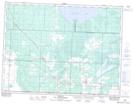
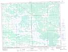
Maps showing Piney Bog, 23-1-11-E, Manitoba
Piney Bog is a Low vegetation located in 23-1-11-E, Manitoba and has an elevation of 327 meters.
- Latitude: 49° 3' 28'' North (decimal: 49.0578000)
- Longitude: 95° 59' 59'' West (decimal: -95.9997000)
- Topography Feature Category: Low vegetation
- Geographical Feature: Bog
- Canadian Province/Territory: Manitoba
- Elevation: 327 meters
- Location: 23-1-11-E
- Atlas of Canada Locator Map: Piney Bog
- GPS Coordinate Locator Map: Piney Bog Lat/Long
Piney Bog NTS Map Sheets