Maps showing Playgreen Lake, Manitoba
Playgreen Lake is a Lake located in Manitoba and has an elevation of 218 meters.
- Latitude: 54° 2' North (decimal: 54.0332999)
- Longitude: 98° 14' West (decimal: -98.2332999)
- Topography Feature Category: Lake
- Geographical Feature: Lake
- Canadian Province/Territory: Manitoba
- Elevation: 218 meters
- Atlas of Canada Locator Map: Playgreen Lake
- GPS Coordinate Locator Map: Playgreen Lake Lat/Long
Playgreen Lake NTS Map Sheets
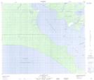
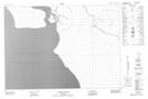
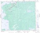
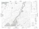
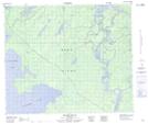
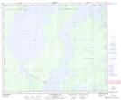
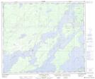
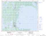
063G16 Mcleod Island Topographic Map at 1:50,000 scale
063H12 Warren Landing Topographic Map at 1:50,000 scale
063H13 Norway House Topographic Map at 1:50,000 scale
063I04 Pine Creek Topographic Map at 1:50,000 scale
063I05 Sugar Falls Topographic Map at 1:50,000 scale
063J01 Kiskittogisu Lake Topographic Map at 1:50,000 scale
063J08 Horsfall Island Topographic Map at 1:50,000 scale
063G Grand Rapids Topographic Map at 1:250,000 scale
063H Norway House Topographic Map at 1:250,000 scale
063I Cross Lake Topographic Map at 1:250,000 scale
063J Weskusko Lake Topographic Map at 1:250,000 scale