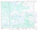
Maps showing Poplarfield, 12-22-2-W, Manitoba
Poplarfield is a Unincorporated area located in 12-22-2-W, Manitoba and has an elevation of 270 meters.
- Latitude: 50° 53' 27'' North (decimal: 50.8908000)
- Longitude: 97° 36' 25'' West (decimal: -97.6069000)
- Topography Feature Category: Unincorporated area
- Geographical Feature: Community
- Canadian Province/Territory: Manitoba
- Elevation: 270 meters
- Location: 12-22-2-W
- Atlas of Canada Locator Map: Poplarfield
- GPS Coordinate Locator Map: Poplarfield Lat/Long
Poplarfield NTS Map Sheets